This instructional plan combined Math SOL 1.5a,b and WIDA English Language Development Standards. The …
This instructional plan combined Math SOL 1.5a,b and WIDA English Language Development Standards. The lesson includes several activity options. Note: Some images may not appear in the "Overview". To view all images in this instructional plan, click "download" at the bottom of the overview.
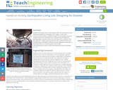
Students learn about factors that engineers take into consideration when designing buildings …
Students learn about factors that engineers take into consideration when designing buildings for earthquake-prone regions. Using online resources and simulations available through the Earthquakes Living Lab, students explore the consequences of subsurface ground type and building height on seismic destruction. Working in pairs, students think like engineers to apply what they have learned to sketches of their own building designs intended to withstand strong-magnitude earthquakes. A worksheet serves as a student guide for the activity.
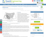
Students learn how engineers characterize earthquakes through seismic data. Then, acting as …
Students learn how engineers characterize earthquakes through seismic data. Then, acting as engineers, they use real-world seismograph data and a tutorial/simulation accessed through the Earthquakes Living Lab to locate earthquake epicenters via triangulation and determine earthquake magnitudes. Student pairs examine seismic waves, S waves and P waves recorded on seismograms, measuring the key S-P interval. Students then determine the maximum S wave amplitudes in order to determine earthquake magnitude, a measure of the amount of energy released. Students consider how engineers might use and implement seismic data in their design work. A worksheet serves as a student guide for the activity.
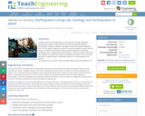
Students study how geology relates to the frequency of large-magnitude earthquakes in …
Students study how geology relates to the frequency of large-magnitude earthquakes in Japan. Using the online resources provided through the Earthquakes Living Lab, students investigate reasons why large earthquakes occur in this region, drawing conclusions from tectonic plate structures and the locations of fault lines. Working in pairs, students explore the 1995 Kobe earthquake, why it happened and the destruction it caused. Students also think like engineers to predict where other earthquakes are likely to occur and what precautions might be taken. A worksheet serves as a student guide for the activity.
Students examine the effects of geology on earthquake magnitudes and how engineers …
Students examine the effects of geology on earthquake magnitudes and how engineers anticipate and prepare for these effects. Using information provided through the Earthquakes Living Lab interface, students investigate how geology, specifically soil type, can amplify the magnitude of earthquakes and their consequences. Students look in-depth at the historical 1906 San Francisco earthquake and its destruction thorough photographs and data. They compare the 1906 California earthquake to another historical earthquake in Kobe, Japan, looking at the geological differences and impacts in the two regions, and learning how engineers, geologists and seismologists work to predict earthquakes and minimize calamity. A worksheet serves as a student guide for the activity.
Students learn the two main methods to measure earthquakes, the Richter Scale …
Students learn the two main methods to measure earthquakes, the Richter Scale and the Mercalli Scale. They make a model of a seismograph a measuring device that records an earthquake on a seismogram. Students also investigate which structural designs are most likely to survive an earthquake. And, they illustrate an informational guide to the Mercalli Scale.
Students learn about water erosion through an experimental process in which small-scale …
Students learn about water erosion through an experimental process in which small-scale buildings are placed along a simulated riverbank to experience a range of flooding conditions. They learn how soil conditions are important to the stability or failure of civil engineering projects and how a river's turns and bends (curvature, sinuosity) make a difference in the likelihood of erosion. They make model buildings either with a 3D printer or with LEGO® pieces and then see how their designs and riverbank placements are impacted by slow (laminar) and fast (turbulent) water flow over the soil. Students make predictions, observations and conclusions about the stability of their model houses, and develop ideas for how to mitigate damage in civil engineering projects.
In this activity on page 1 of the PDF, learners compare the …
In this activity on page 1 of the PDF, learners compare the relative sizes of biological objects (like DNA and bacteria) that can't be seen by the naked eye. Learners will be surprised to discover the range of sizes in the microscopic world. This activity can be followed up with a second activity, "What's in a microbe?", located on page 3 in the same resource.
No restrictions on your remixing, redistributing, or making derivative works. Give credit to the author, as required.
Your remixing, redistributing, or making derivatives works comes with some restrictions, including how it is shared.
Your redistributing comes with some restrictions. Do not remix or make derivative works.
Most restrictive license type. Prohibits most uses, sharing, and any changes.
Copyrighted materials, available under Fair Use and the TEACH Act for US-based educators, or other custom arrangements. Go to the resource provider to see their individual restrictions.