Updating search results...

Search Resources

10 Results

View
Selected filters:
  • earth-and-space-science
Buildings and Earthquakes
Read the Fine Print
Educational Use
Rating
0.0 stars

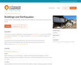
Earthquakes happen when forces in the Earth cause violent shaking of the ground. Earthquakes can be very destructive to buildings and other man-made structures. Design and build various types of buildings, then test your buildings for earthquake resistance using a shake table and a force sensor that measures how hard a force pushes or pulls your building.

Subject:
Science
Material Type:
Activity/Lab
Lecture Notes
Provider:
Concord Consortium
Provider Set:
Concord Consortium Collection
Author:
The Concord Consortium
Date Added:
05/21/2012
Dew Point
Read the Fine Print
Educational Use
Rating
0.0 stars

Determine the dew point temperature for your classroom through a hands-on experiment. Use humidity and temperature probes to investigate the temperature at which it would rain in your classroom! Learn about water density and the conditions necessary to produce fog or rain.

Subject:
Science
Material Type:
Activity/Lab
Lecture Notes
Provider:
Concord Consortium
Provider Set:
Concord Consortium Collection
Author:
The Concord Consortium
Date Added:
12/13/2011
Geosleut
Unrestricted Use
CC BY
Rating
0.0 stars

GeoSleuth Murder Mystery
U.S. Geologic Service Educator Lesson Plans

LINK: https://www.usgs.gov/science-support/osqi/yes/resources-teachers/school-yard-geology

Lesson Overview

This murder mystery introduces both the nature of scientific inquiry and important geologic concepts in a very student-friendly, accessible manner. Geology is a lot like detective work. The power of this exercise is that it exposes students to the main goals of geology and even some of the fundamental principles in a setting that they can understand -- a murder mystery. After the class explores the murder mystery, the teacher then shows a range of geologic photos that relate to features in the mystery.

Learning Outcomes
Geologists reconstruct the sequence of events that shaped the present-day landscape by making observations.
Observations are different from interpretations.
Observations are descriptions of things we see. Interpretations are stories about what happened that are based on the observations.
Events that happened in the past are similar to events that we observe today. They follow the same laws of physics.

Materials
Presentation (either as overhead transparency or computer projector). The activity is based around the GeoSleuth murder mystery drawing, shown on the lesson link provided.

Materials have two options:

1. Recommended: Download a prepared presentation complete with the image, supplementary geologic images, and a teacher's guide.

2. Presentation: Powerpoint or Acrobat PDF ~ 3 MB; Teacher's Guide: Acrobat PDF, 1 MB Use the image provided and show on a projector or print it on transparency.

Procedures
1. Have students look at the photo for 1 minute silently by themselves.

2. Ask students to list observations about the image. Write them down on the board as students give them. Be very clear about the difference between observations and interpretation and don't write any interpretations on the board.

3. When you have collected all the observations, ask the class if everyone agrees with these observations.

4. Now the fun begins. Ask for students to volunteer their interpretation about the sequence of events that happened.

5. Let chaos reign for a few minutes as students argue competing theories.

6. Summarize the different interpretations, highlighting the geologic principles that each theory depends upon (shown below).

7. Show the geologic images from the Powerpoint presentation.

8. Put the murder mystery image up and go over the geologic principles again.

9. End class without giving them an answer about what really happened.

Closing the Lesson
It's key to end the activity by returning to the GeoSleuth murder mystery photo. You should not, however, give students a definitive answer to the mystery. That's part of the nature of science -- there is never a right answer. There is only a "best answer," meaning one that is most consistent with the observations and most likely to be true. Different scientists often disagree about which answer is best, even when looking at the same data. This is because data are often incomplete or have large uncertainty.

Homework/Exension
Students can write their own murder mystery, carefully trying to integrate clues that will give the reader evidence of the sequence of events leading up to the murder.
Subject:
Earth and Space Systems
Science
Material Type:
Activity/Lab
Date Added:
08/03/2019
Geosleuth Murder Mystery
Unrestricted Use
CC BY
Rating
0.0 stars

GeoSleuth Murder Mystery
U.S. Geologic Service Educator Lesson Plans

LINK: https://prd-wret.s3-us-west-2.amazonaws.com/assets/palladium/production/s3fs-public/atoms/files/lessonthreeGeoSleuth_3.pdf

Lesson Overview

This murder mystery introduces both the nature of scientific inquiry and important geologic concepts in a very student-friendly, accessible manner. Geology is a lot like detective work. The power of this exercise is that it exposes students to the main goals of geology and even some of the fundamental principles in a setting that they can understand -- a murder mystery. After the class explores the murder mystery, the teacher then shows a range of geologic photos that relate to features in the mystery.

Learning Outcomes
Geologists reconstruct the sequence of events that shaped the present-day landscape by making observations.
Observations are different from interpretations.
Observations are descriptions of things we see. Interpretations are stories about what happened that are based on the observations.
Events that happened in the past are similar to events that we observe today. They follow the same laws of physics.

Materials
Presentation (either as overhead transparency or computer projector). The activity is based around the GeoSleuth murder mystery drawing, shown on the lesson link provided.

Materials have two options:

1. Recommended: Download a prepared presentation complete with the image, supplementary geologic images, and a teacher's guide.

2. Presentation: Powerpoint or Acrobat PDF ~ 3 MB; Teacher's Guide: Acrobat PDF, 1 MB Use the image provided and show on a projector or print it on transparency.

Procedures
1. Have students look at the photo for 1 minute silently by themselves.

2. Ask students to list observations about the image. Write them down on the board as students give them. Be very clear about the difference between observations and interpretation and don't write any interpretations on the board.

3. When you have collected all the observations, ask the class if everyone agrees with these observations.

4. Now the fun begins. Ask for students to volunteer their interpretation about the sequence of events that happened.

5. Let chaos reign for a few minutes as students argue competing theories.

6. Summarize the different interpretations, highlighting the geologic principles that each theory depends upon (shown below).

7. Show the geologic images from the Powerpoint presentation.

8. Put the murder mystery image up and go over the geologic principles again.

9. End class without giving them an answer about what really happened.

Closing the Lesson
It's key to end the activity by returning to the GeoSleuth murder mystery photo. You should not, however, give students a definitive answer to the mystery. That's part of the nature of science -- there is never a right answer. There is only a "best answer," meaning one that is most consistent with the observations and most likely to be true. Different scientists often disagree about which answer is best, even when looking at the same data. This is because data are often incomplete or have large uncertainty.

Homework/Exension
Students can write their own murder mystery, carefully trying to integrate clues that will give the reader evidence of the sequence of events leading up to the murder.

Subject:
Earth and Space Systems
Science
Material Type:
Activity/Lab
Date Added:
08/03/2019
Greenhouse Effect in a Greenhouse
Read the Fine Print
Educational Use
Rating
0.0 stars

Build your own miniature "greenhouse" out of a plastic container and plastic wrap, and fill it with different things such as dirt and sand to observe the effect this has on temperature. Monitor the temperature using temperature probes and digitally plot the data on the graphs provided in the activity.

Subject:
Science
Material Type:
Activity/Lab
Provider:
Concord Consortium
Provider Set:
Concord Consortium Collection
Author:
The Concord Consortium
Date Added:
12/13/2011
Greenhouse Gases
Read the Fine Print
Educational Use
Rating
0.0 stars

Explore how the Earth's atmosphere affects the energy balance between incoming and outgoing radiation. Using an interactive model, adjust realistic parameters such as how many clouds are present or how much carbon dioxide is in the air, and watch how these factors affect the global temperature.

Subject:
Science
Material Type:
Activity/Lab
Data Set
Provider:
Concord Consortium
Provider Set:
Concord Consortium Collection
Author:
The Concord Consortium
Date Added:
12/13/2011
Greenhouse Light and Temperature
Read the Fine Print
Educational Use
Rating
0.0 stars

Make your own miniature greenhouse and measure the light levels at different "times of day"--modeled by changing the angle of a lamp on the greenhouse--using a light sensor. Next, investigate the temperature in your greenhouse with and without a cover. Learn how a greenhouse works and how you can regulate the temperature in your model greenhouse.

Subject:
Science
Material Type:
Activity/Lab
Provider:
Concord Consortium
Provider Set:
Concord Consortium Collection
Author:
The Concord Consortium
Date Added:
12/13/2011
Making a Tennis Ball Globe
Only Sharing Permitted
CC BY-NC-ND
Rating
0.0 stars

A globe is a world map on the surface of a small sphere that
represents the Earth. Of all the world maps, the globe is the easiest
to understand because it gives us the most realistic picture of the
Earth and has the same attributes as the Earth; round and immense,
and impossible to see all at once. Spatial attributes such as distance,
direction, shape, and area are preserved as well as the continuity of
the all-curved surface. Globes represent the best possible map
projection because they include a minimum of distortion and are the
ultimate in geographic realism.

This lab requires students to construct 2 globes using tennis balls as the base structure and the world maps linked here.

LINK: https://prd-wret.s3-us-west-2.amazonaws.com/assets/palladium/production/s3fs-public/atoms/files/Make%20Your%20Own%20Earth%20and%20Tectonic%20Globes.pdf

Each of the world maps is composed of twelve gores that are
designed to be attached to a tennis ball.

Each gore has a width of 30°, the time it takes the sun to travel two hours over the surface of the Earth.

The twelve gores can be cut into four groups of three gores each and glued onto the tennis ball, or the gores can be glued on as a group of twelve.

Either way, it is important to have the equator divide the tennis ball into two equal parts and for the equator to be in a straight line.

See instructions described in the link above for proper construction on pages 9 and 10 the report linked above.

Subject:
Earth and Space Systems
Science
Material Type:
Activity/Lab
Date Added:
07/17/2019
Radiant Energy Flow
Read the Fine Print
Educational Use
Rating
0.0 stars

How does energy flow in and out of our atmosphere? Explore how solar and infrared radiation enters and exits the atmosphere with an interactive model. Control the amounts of carbon dioxide and clouds present in the model and learn how these factors can influence global temperature. Record results using snapshots of the model in the virtual lab notebook where you can annotate your observations.

Subject:
Science
Material Type:
Activity/Lab
Data Set
Lecture Notes
Provider:
Concord Consortium
Provider Set:
Concord Consortium Collection
Author:
The Concord Consortium
Date Added:
12/11/2011
Relative Humidity Measurement
Read the Fine Print
Educational Use
Rating
0.0 stars

Measure relative humidity in the air using a simple device made of a temperature sensor, a plastic bottle, and some clay. Electronically plot the data you collect on graphs to analyze and learn from it. Experiment with different materials and different room temperatures in order to explore what affects humidity.

Subject:
Science
Material Type:
Activity/Lab
Provider:
Concord Consortium
Provider Set:
Concord Consortium Collection
Author:
The Concord Consortium
Date Added:
12/12/2011