Updating search results...

Search Resources

9 Results

View
Selected filters:
  • remote-sensing
Beyond the Milky Way
Read the Fine Print
Educational Use
Rating
0.0 stars

When we look at the night sky, we see stars and the nearby planets of our own solar system. Many of those stars are actually distant galaxies and glowing clouds of dust and gases called nebulae. The universe is an immense space with distances measured in light years. The more we learn about the universe beyond our solar system, the more we realize we do not know. Students are introduced to the basic known facts about the universe, and how engineers help us explore the many mysteries of space.

Subject:
Science
Scientific and Engineering Practices
Material Type:
Activity/Lab
Lesson Plan
Provider:
TeachEngineering
Provider Set:
TeachEngineering
Author:
Denise W. Carlson
Jane Evenson
Jessica Butterfield
Jessica Todd
Malinda Schaefer Zarske
Sam Semakula
Date Added:
09/18/2014
Habitat Mapping
Read the Fine Print
Educational Use
Rating
0.0 stars

The marine environment is unique and requires technologies that can use sound to gather information since there is little light underwater. The sea-floor is characterized using underwater sound and acoustical systems. Current technological innovations are allowing scientists to further understand and apply information about animal locations and habitat. Remote sensing and exploration with underwater vehicles allows scientists to map and understand the sea floor, and in some cases, the water column. In this lesson, the students will be shown benthic habitat images produced by GIS. These imaged will lead to a class discussion on why habitat mapping is useful and how current technology works to make bathymetry mapping possible. The teacher will then ask inquiry-based questions to have students brainstorm about the importance of bathymetry mapping.

Subject:
Science
Scientific and Engineering Practices
Material Type:
Activity/Lab
Lesson Plan
Provider:
TeachEngineering
Provider Set:
TeachEngineering
Author:
Heather Kerkering
Jonelle Stovall
Kimberly Goetz
Melissa Sanderson
Date Added:
09/18/2014
Hands-on Activities That Simulate Polar Science
Conditional Remix & Share Permitted
CC BY-SA
Rating
0.0 stars

This article highlights science lessons and activities that can help elementary students gain an understanding of the tools and technology involved in polar research. Suggestions for literacy integration are provided, and activities are aligned to national standards.

Subject:
Earth Resources
Science
Material Type:
Lesson Plan
Provider:
Ohio State University College of Education and Human Ecology
Provider Set:
Beyond Penguins and Polar Bears: An Online Magazine for K-5 Teachers
Author:
Jessica Fries-Gaither
Date Added:
05/29/2019
Let's Get Breezy!
Read the Fine Print
Educational Use
Rating
0.0 stars

With the assistance of a few teacher demonstrations (online animation, using a radiometer and rubbing hands), students review the concept of heat transfer through convection, conduction and radiation. Then they apply an understanding of these ideas as they use wireless temperature probes to investigate the heating capacity of different materials sand and water under heat lamps (or outside in full sunshine). The experiment models how radiant energy drives convection within the atmosphere and oceans, thus producing winds and weather conditions, while giving students the hands-on opportunity to understand the value of remote-sensing capabilities designed by engineers. Students collect and record temperature data on how fast sand and water heat and cool. Then they create multi-line graphs to display and compare their data, and discuss the need for efficient and reliable engineer-designed tools like wireless sensors in real-world applications.

Subject:
Science
Scientific and Engineering Practices
Material Type:
Activity/Lab
Provider:
TeachEngineering
Provider Set:
TeachEngineering
Author:
Constance Garza
Mounir Ben Ghalia
Date Added:
10/14/2015
Map That Habitat
Read the Fine Print
Educational Use
Rating
0.0 stars

Historically, seafloor mapping occurred with a simple data collection method: soundings. Soundings are taken by dropping a weight with a pre-measured rope off the side of a boat and noting the measurement on the rope when the weight hits the bottom. In this activity, student teams replicate the creation of seafloor bathymetry by taking a simplified form of soundings of an unseen seafloor model inside a shoebox and translating their collected data into a visualization of the topography, enabling them to better understand and appreciate modern remote sensing.

Subject:
Science
Scientific and Engineering Practices
Material Type:
Activity/Lab
Provider:
TeachEngineering
Provider Set:
TeachEngineering
Author:
Heather Kerkering
Jonelle Stovall
Kimberly Goetz
Melissa Sanderson
Date Added:
10/14/2015
Marine Mapping
Read the Fine Print
Educational Use
Rating
0.0 stars

The marine environment is unique and because little light penetrates under water, technologies that use sound are required to gather information. The seafloor is characterized using underwater sound and acoustical systems. Current technological innovations enable scientists to further understand and apply information about animal locations and habitat. Remote sensing and exploration with underwater vehicles enables researchers to map and understand the sea floor. Similar technologies also aid in animal tracking, a method used within science and commercial industries. Through inquiry-based learning techniques, students learn the importance of habitat mapping and animal tracking.

Subject:
Science
Scientific and Engineering Practices
Material Type:
Full Course
Provider:
TeachEngineering
Provider Set:
TeachEngineering
Author:
Heather Kerkering
Jonelle Stovall
Kimberly Goetz
Melissa Sanderson
Date Added:
10/14/2015
Mind Bending GPS Occultations
Read the Fine Print
Educational Use
Rating
0.0 stars

Students learn about the remote sensing radio occultation technique and how engineers use it with GPS satellites to monitor and study the Earth's atmospheric activity. Students may be familiar with some everyday uses of GPS, but not as familiar with how GPS technology contributes to our ongoing need for great amounts of ever-changing global atmospheric data for accurate weather forecasting, storm tracking and climate change monitoring. GPS occultations are when GPS signals sent from one satellite to another are altered (delayed, refracted) by the atmosphere passed though, such that they can be analyzed to remotely learn about the planet's atmospheric conditions.

Subject:
Science
Scientific and Engineering Practices
Material Type:
Lesson Plan
Provider:
TeachEngineering
Provider Set:
TeachEngineering
Author:
Jonah Kisesi
Marissa H. Forbes
Penina Axelrad
Date Added:
09/18/2014
NASA eClips Our World:  Where Do Crops Grow?
Unrestricted Use
Public Domain
Rating
0.0 stars

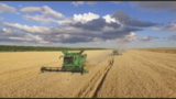
Video Description:  Have you ever wondered where food comes from? Learn how Dr. Catherine Nakalembe uses NASA satellite data to show the health and location of crops around Our World. Maps created from these data help people become more food secure. You can help, too. Using the GLOBE Observer App, you can help scientists validate satellite data by describing land covering through the Adopt a Pixel program.  Video Length:  5:23.    NASA eClipsTM is a suite of online student-centered, standards-based resources that support instruction by increasing STEM literacy in formal and nonformal settings.  These free digital and downloadable resources inform and engage students through NASA-inspired, real-world connections.NASA eClips Our World videos (grades 3-5) help students understand the differences between science (the natural world) and engineering (the designed world).  These video segments supplement elementary learning objectives not only in science, technology, engineering and mathematics, but also in reading, writing, visual and performing arts. 

Subject:
Agricultural Education
Algorithms and Programming
Data and Analysis
Earth Resources
Impacts of Computing
STEM/STEAM
Science
Material Type:
Visual Media
Author:
Betsy McAllister
Date Added:
01/19/2022
Remote Sensing Makes Sense in the Polar Regions
Conditional Remix & Share Permitted
CC BY-SA
Rating
0.0 stars

This article describes Katy Farness' work with the Byrd Polar Research Center at the Ohio State University. Farness used remote sensing images and computer technology to create detailed images of Antarctica and the ice sheets of Greenland.

Subject:
Earth Resources
Science
Material Type:
Reading
Provider:
Ohio State University College of Education and Human Ecology
Provider Set:
Beyond Penguins and Polar Bears: An Online Magazine for K-5 Teachers
Author:
Jessica Fries-Gaither
Date Added:
05/29/2019