GeoSleuth Murder Mystery
U.S. Geologic Service Educator Lesson Plans
LINK: https://prd-wret.s3-us-west-2.amazonaws.com/assets/palladium/production/s3fs-public/atoms/files/lessonthreeGeoSleuth_3.pdf
Lesson Overview
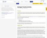
This murder mystery introduces both the nature of scientific inquiry and important geologic concepts in a very student-friendly, accessible manner. Geology is a lot like detective work. The power of this exercise is that it exposes students to the main goals of geology and even some of the fundamental principles in a setting that they can understand -- a murder mystery. After the class explores the murder mystery, the teacher then shows a range of geologic photos that relate to features in the mystery.
Learning Outcomes
Geologists reconstruct the sequence of events that shaped the present-day landscape by making observations.
Observations are different from interpretations.
Observations are descriptions of things we see. Interpretations are stories about what happened that are based on the observations.
Events that happened in the past are similar to events that we observe today. They follow the same laws of physics.
Materials
Presentation (either as overhead transparency or computer projector). The activity is based around the GeoSleuth murder mystery drawing, shown on the lesson link provided.
Materials have two options:
1. Recommended: Download a prepared presentation complete with the image, supplementary geologic images, and a teacher's guide.
2. Presentation: Powerpoint or Acrobat PDF ~ 3 MB; Teacher's Guide: Acrobat PDF, 1 MB Use the image provided and show on a projector or print it on transparency.
Procedures
1. Have students look at the photo for 1 minute silently by themselves.
2. Ask students to list observations about the image. Write them down on the board as students give them. Be very clear about the difference between observations and interpretation and don't write any interpretations on the board.
3. When you have collected all the observations, ask the class if everyone agrees with these observations.
4. Now the fun begins. Ask for students to volunteer their interpretation about the sequence of events that happened.
5. Let chaos reign for a few minutes as students argue competing theories.
6. Summarize the different interpretations, highlighting the geologic principles that each theory depends upon (shown below).
7. Show the geologic images from the Powerpoint presentation.
8. Put the murder mystery image up and go over the geologic principles again.
9. End class without giving them an answer about what really happened.
Closing the Lesson
It's key to end the activity by returning to the GeoSleuth murder mystery photo. You should not, however, give students a definitive answer to the mystery. That's part of the nature of science -- there is never a right answer. There is only a "best answer," meaning one that is most consistent with the observations and most likely to be true. Different scientists often disagree about which answer is best, even when looking at the same data. This is because data are often incomplete or have large uncertainty.
Homework/Exension
Students can write their own murder mystery, carefully trying to integrate clues that will give the reader evidence of the sequence of events leading up to the murder.