This is the second lesson of two on the Byzantine Empire. Throughout …
This is the second lesson of two on the Byzantine Empire. Throughout the course of world history, borders have changed as various groups of people competed to control and rule territory and acquire resources. Throughout time, empires have expanded and collapsed. The Byzantine Empire once occupied the eastern portion of the Roman Empire with Constantinople as its capital, but yet disappeared from the map in 1453 when Constantinople became the capital of Ottoman Empire. Through an investigation of a series of map layers and examination of an interactive Web site, students discover how and why the borders of the Byzantine Empire changed through time. Key questions: What factors influence border changes? What are the effects of changing borders?
While the heyday of the canals lasted only a few decades, they …
While the heyday of the canals lasted only a few decades, they transformed the American economy by connecting the areas west of the Appalachian Mountains to eastern population centers and Atlantic ports. Concentrated largely north of the Mason-Dixon line, they shaped American regionalism too by linking the northeast and northwest together into a region that increasingly came to see itself as the "North."
explores Central Vermont's history using 43 historic places that recall past eras …
explores Central Vermont's history using 43 historic places that recall past eras when numerous small villages grew slowly until the coming of the railroad, which resulted in a period of rapid growth for Vermont in the last half of the 19th century.
Summary of three-day event in which teachers centered on changing patters of …
Summary of three-day event in which teachers centered on changing patters of agriculture that involved both classroom instruction and a field experience. Spectific curriculum topics included sustainability, urban agriculture, environmental ethics, and women in agriculture; skills such as formal observation, data collection, landscape analysis, speculation and spatial analysis; and processes such as climate change, economic development, and the Geo-Inquiry process. Contains links to numerous resources.
Lecture notes on changing speech and culture relations in Southwest Virginia. Historical …
Lecture notes on changing speech and culture relations in Southwest Virginia. Historical overview of Southern Appalachian Speech practices with a Virginia emphasis.
Lecture notes on a discussion of climate change and its impact on …
Lecture notes on a discussion of climate change and its impact on agriculture as well as overall human health concerns. Climate change is placed in a historical context and speculated on ways in which future human existence may be altered as a result of a changing climate.
examines one of the most extensive and best-preserved concentrations of prehistoric rock …
examines one of the most extensive and best-preserved concentrations of prehistoric rock art in the U.S. See photos and learn about the people who made these 250,000 drawings on rocks at China Lake, California, 1000 to 3000 years ago.
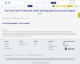
The Did You Feel It (DYFI) Annual Summary Webage and Viewer are …
The Did You Feel It (DYFI) Annual Summary Webage and Viewer are resources that are ideal for Earth Science and Geography laboratiory activitiy.
Students may connect to a database of factual information collected by the USGS on Earthquakes and other seismic disturbances.
The data graphically shows the highest intensity felt at each location searched. The data is grouped into 10 km blocks, and the color of each block corresponds to the highest intensity calculated for that block (regardless of which event).
is a travel itinerary that highlights 45 historic places that help tell …
is a travel itinerary that highlights 45 historic places that help tell the story of Spanish colonization of California. Learn about forts, churches, adobe houses, historic districts, and other places. Find out about the Presidio, which was established in 1769 as the base for Spain's colonization efforts and was the first permanent European settlement on the Pacific Coast.
The third of three lessons on Eastern Hemisphere examine how the physical …
The third of three lessons on Eastern Hemisphere examine how the physical environment influences human activities. Through maps students examine the link between the physical environment and distribution of cultures within Africa. They will consider the sequence and locations of various African empires as they consider how the environment affected their growth and longevity. They will also examine a Story Map Tour of images associated with each of the empires and note key characteristics of the societies. Key Questions: How did physical geography influence the distribution of cultures within Africa?; How do artifacts and buildings convey information about past civilizations?
The second of three lessons on Eastern Hemisphere, students learn how physical …
The second of three lessons on Eastern Hemisphere, students learn how physical environment influences human activities. Silk roads connected Europe with China and other areas of East Asia by overland routes. Deserts and mountains posed obstacles for travelers and merchants. Students examine physical maps of the area and determine which routes would best avoid obstacles. They compare the routes they have chosen with the overland and maritime routes of the time period. Key questions: How did physical geography influence the trade routes of the silk roads? Why Europeans traded with China? What are the costs and benefits of cultural interaction?
The first of three lessons on Eastern Hemisphere, students examine maps to …
The first of three lessons on Eastern Hemisphere, students examine maps to discover the link between the physical environment and the distribution of cultures. Key questions: How did physical geography influence the distribution of cultures within the eastern hemisphere?; How does the physical environment link and divide regions?
This site provides more than 40 lesson ideas developed by teachers to …
This site provides more than 40 lesson ideas developed by teachers to help students learn about Eastern Woodland Native Americans who lived in the upper Mississippi River valley (southwestern Wisconsin and northeast Iowa) from about 500 BC to 1300 AD and who built effigies -- ceremonial burial mounds shaped to represent bears, eagles, falcons, bison, deer, turtles, lizards, and other creatures.
The most democratic body in the federal government, hundreds of representatives for …
The most democratic body in the federal government, hundreds of representatives for the House are elected every other year. This site maps elections from before the Civil War until today showing changing patterns across regions and between urban and rural areas.
The second of two lessons of Europe in Middle Ages, students examine …
The second of two lessons of Europe in Middle Ages, students examine primary and secondary sources of Viking invasions. Information is uncovered about areas invaded, conduct of invaders, and effects on populations invaded. Students then examine maps to determine the sequence of Viking invasions. Key questions: What do sources tell us about Viking invasions?; How did physical geography influence Viking invasions and patterns of settlement?; How did Viking invasions change over time?; How did invasions of the Magyars and Vikings differ?
The first of two lessons on territorial extent of empires in Europe …
The first of two lessons on territorial extent of empires in Europe in 814 at the end of Charlemagne’s rule and another after the death of Charlemagne. Students extend and refine their map interpretation skills by examining the use of color to denote territorial ownership. In addition, students make predictions about likely paths of invasion. Key questions: How do physical geography, cultural, economic, and political factors affect borders? To what extent does the physical environment define borders?
Third of three lessons on the changing European borders, students learn about …
Third of three lessons on the changing European borders, students learn about diffusion of the Black Death. The spread of the Black Death illustrates interaction as people, goods, and ideas move through both time and space. The Black Death decimated the population of Europe in the 1300s. Key questions: Where did the Black Death originate? How did the Black Death arrive in Europe? How did the Black Death affect life in Europe?
First of three lessons examine changing European borders, students compare maps illustrating …
First of three lessons examine changing European borders, students compare maps illustrating changes of Europe's division of territory from 1000 A.D. (C.E.) to 1450 A.D. (C.E.). Unification of smaller regions into a larger state may form the basis for political power and the ability to exert influence over other countries. Students uncover the relationship between territorial extent and political power. Key questions: How did the consolidation of territory affect the formation of nation states?; How could stable borders contribute to the political stability of a state?
Second of three lessons on changing European borders, students determine the general …
Second of three lessons on changing European borders, students determine the general routes and time span of the Crusades through maps depicting their routes. Includes primary sources to support comparison of the accounts of the Crusader victory in capturing Jerusalem in 1099. Concludes with an evaluation of crusades' success. Key questions: What areas were involved in the Crusades? What areas did the Crusader states seek to control? What role did the Byzantine church play in the Crusades and how they affected the Byzantines? How did the establishment of Crusader states influence the fall of Constantinople?
No sitting American president traveled outside the country before Theodore Roosevelt traveled …
No sitting American president traveled outside the country before Theodore Roosevelt traveled to Panama in 1906 to see the construction of the Panama Canal. A century later Air Force One regularly carries the head of the executive branch to all corners of the world. The Executive Abroad maps the international trips of presidents and secretaries of state.
No restrictions on your remixing, redistributing, or making derivative works. Give credit to the author, as required.
Your remixing, redistributing, or making derivatives works comes with some restrictions, including how it is shared.
Your redistributing comes with some restrictions. Do not remix or make derivative works.
Most restrictive license type. Prohibits most uses, sharing, and any changes.
Copyrighted materials, available under Fair Use and the TEACH Act for US-based educators, or other custom arrangements. Go to the resource provider to see their individual restrictions.