Your students are archeologists at the Jamestown Settlement. The settlement directors (teachers) would …
Your students are archeologists at the Jamestown Settlement. The settlement directors (teachers) would like to include information on the new website, and the students have been asked to make a program (ie presentation) on settlers first arriving in Jamestown and their first few years there. They must target this program to people who are not familiar with the Jamestown settlement to attract their attention and curiosity to want to see more of the settlement and get them to come visit Jamestown. Their program’s artifact should include pictures of real artifacts, maps, etc to help explain the sequence (ie timeline) of events or tell the story of the beginning of the settlement. They should include a brief explanation with each slide. They will present their presentation to peers who will give feedback as potential visitors to Jamestown.
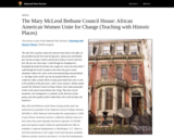
As a historic unit of the National Park Service, the Mary McLeod …
As a historic unit of the National Park Service, the Mary McLeod Bethune Council House is listed in the National Register of Historic Places. The site also is within the boundaries of the Logan Circle Historic District. This lesson is based on the Historic Resources Study for Mary McLeod Bethune Council House National Historic Site, as well as other materials on Bethune and the National Council of Negro Women. The lesson was written by Brenda K. Olio, former Teaching with Historic Places historian, and edited by staff of the Teaching with Historic Places program and Mary McLeod Bethune Council House National Historic Site.
First of two lessons on agriculatural tends in America. This one looks …
First of two lessons on agriculatural tends in America. This one looks at the number of farms, average farm size, and amount of land in farms from 1850 through 2012.
Second of two lessons on agriculatural tends in America. This one uses …
Second of two lessons on agriculatural tends in America. This one uses ArcGIS online that follows simple step-by-step directions to create a web map. Students will learn how farm size, average farm output, and type of farming vary across the U.S.
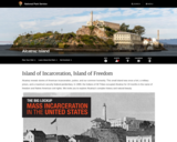
Alcatraz is home to one of the world's most infamous prisons. From …
Alcatraz is home to one of the world's most infamous prisons. From the 1930s to 1960s, Alcatraz was the premier maximum security prison, housing inmates such as Al Capone and George Machine Gun Kelly. Before the prison was created, the island was home to American Indians. Today, it is one of San Francisco's most prominent tourist attractions.
presents a travel itinerary of 58 historic places across Arizona, Colorado, and …
presents a travel itinerary of 58 historic places across Arizona, Colorado, and New Mexico. It includes forts built to protect mail routes and settlers, missions and churches, prehistoric cliff dwellings, trading posts, petroglyphs (from the petrified forest), pit house villages, and Indian villages home to the Anasazi, Sinagua, Zuni, and other Native American tribes.
In the second lesson of four on Ancient Greece, students refine their …
In the second lesson of four on Ancient Greece, students refine their knowledge of physical features as they investigate pictures of Greece and determine how a particular physical feature influenced human action. Key question: How did the physical geography of the Aegean basin shape the economic, social and political development of Greek civilization?
In the first lesson of four on Ancient Greece, students use geographic …
In the first lesson of four on Ancient Greece, students use geographic terms such as hemispheres, continents, and direction to describe the relative location of Greece within the world, within Europe, and within the Aegean Basin. In addition, students extend and refine their ability to identify various types of physical features on maps at a variety of scales. Students examine maps to identify and describe the physical environment of Greece. Key questions: Where is ancient Greece located?; What are physical features of the Aegean Basin?; How did the location of Greece and its physical environment influence its interaction with the rest of the world?
In the third lesson of four on Ancient Greece, students simulate trade …
In the third lesson of four on Ancient Greece, students simulate trade between Greek city states and their colonies. The overall goal is for the Greek traders and colonists to travel to new territories, trade resources, and as a result build an empire and spread Hellenistic culture. Through the examination of the goods exchanged, students gain a basic understanding of specialization in the various areas of the Mediterranean Basin. Key questions: Why did the Greeks acquire colonies?; How did Greek culture diffuse throughout the Mediterranean world?; What were the effects of the diffusion of Greek culture?
In the last lesson of four on Ancient Greece, students employ spatial …
In the last lesson of four on Ancient Greece, students employ spatial thinking to understand the extent of the empire of Alexander the Great by examining and comparing visuals and maps. Key question: How does the geographic extent of an empire influence its ability to exist through time?
In the first of two lessons on ancient river valley civilization, students …
In the first of two lessons on ancient river valley civilization, students examine the physical environment of the early river valley civilizations. After identifying the locations of the ancient civilizations, students complete a feature analysis to assist them in comparing the physical environments and determining how it afforded protection to the civilizations. Key questions: Why was a river valley a good place for a settlement? What was the significance of these river valley civilizations?
In the second of two lessons on ancient river valley civilizations, students …
In the second of two lessons on ancient river valley civilizations, students examine the physical environment of the early river valley civilizations. Moving water carries and sorts sediment, changes landforms, and creates strata. The sediment becomes the base for soil formation, and it is the material of which flood plains, deltas, and natural levees are built. Through a demonstration of the sedimentation process, students will come to understand the significance of the process and seasonal flooding to agricultural activity in the early river valley civilizations. Key questions: How does the process of sedimentation affect soil fertility? Why are some river valleys good sites for human settlement?
The first lesson of two on Ancient Rome, students examine physical maps …
The first lesson of two on Ancient Rome, students examine physical maps of Rome to identify physical features that provided security for the site of Rome. In addition, students examine the relative location of Rome and its connections within the Mediterranean Basin and beyond. The second segment of the lesson examines the expansion of the Roman Empire through time and the role of physical features in facilitating or hindering that expansion. Key questions: What are the physical features of Rome?; How did the physical geography of Rome influence its development?
The second lesson of two on Ancient Rome, students examine the geographic …
The second lesson of two on Ancient Rome, students examine the geographic extent of the Roman Empire. The Orbis Web site, hosted by Stanford University, provides a map of the Roman Empire at its largest extent with the locations of key cities and transportation links. Key questions: How were places within the Roman Empire connected?; How did time and distance affect interactions within the Roman Empire?
Help students learn about archaeological methods and how archaeological interpretations are made. …
Help students learn about archaeological methods and how archaeological interpretations are made. It is organized around questions that include: What is archeology? What do archaeologists do? How do archaeologists determine how old things are?
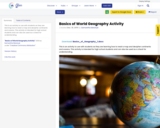
This is an activity to use with students as they are learning …
This is an activity to use with students as they are learning how to read a map and decipher continents and oceans. This activity is intended for high school students and can also be used as a check for understanding.
This is an activity to use with students as they are learning …
This is an activity to use with students as they are learning how to read a map and decipher continents and oceans. This activity is intended for high school students and can also be used as a check for understanding.
This is an activity to use with students as they are learning …
This is an activity to use with students as they are learning how to read a map and decipher continents and oceans. This activity is intended for high school students and can also be used as a check for understanding.
features Monroe Elementary, the school attended in 1950 by third grader Linda …
features Monroe Elementary, the school attended in 1950 by third grader Linda Brown. Because she was black, Brown was barred from attending a white school much closer to her home. The cases brought by father and others led to the Supreme Court's unanimous decision in 1954 that racial segregation in public schools was unconstitutional.
The first lesson of two on Byzantine Empire, students evaluate various sites …
The first lesson of two on Byzantine Empire, students evaluate various sites for a city that is in an ideal location to interact with the three continents bordering the Mediterranean basin. As students examine the local characteristics of the sites, they begin to consider the links between places. Even though the “ownership” of the site of Constantinople (Istanbul) has changed through time, its role as a crossroads has remained constant. Key questions: How does the location of Constantinople influence its ability to interact with the rest of the world? Why is Constantinople a strategic location?
No restrictions on your remixing, redistributing, or making derivative works. Give credit to the author, as required.
Your remixing, redistributing, or making derivatives works comes with some restrictions, including how it is shared.
Your redistributing comes with some restrictions. Do not remix or make derivative works.
Most restrictive license type. Prohibits most uses, sharing, and any changes.
Copyrighted materials, available under Fair Use and the TEACH Act for US-based educators, or other custom arrangements. Go to the resource provider to see their individual restrictions.