No sitting American president traveled outside the country before Theodore Roosevelt traveled …
No sitting American president traveled outside the country before Theodore Roosevelt traveled to Panama in 1906 to see the construction of the Panama Canal. A century later Air Force One regularly carries the head of the executive branch to all corners of the world. The Executive Abroad maps the international trips of presidents and secretaries of state.
visits 65 historic places along 75 miles of Route 15 in Virginia's …
visits 65 historic places along 75 miles of Route 15 in Virginia's Piedmont. Stops include homes of Thomas Jefferson and James Monroe; sites of some of the bloodiest battles in the Civil War; and other places that evoke the soldiers, statesmen, farmers, and slaves who fought, toiled, and governed there.
explores Kingston's over 300 years of history using 24 historic places that …
explores Kingston's over 300 years of history using 24 historic places that recall past eras when settlers and Native Americans warily shared its plains, proud Revolutionaries and angry British armies walked its narrow streets and when coal, limestone and even patent medicines flowed along its canals. The Dutch established Kingston 1652 and it became an active participant in the American Revolution and a major river-port during New York's 19th-century canal and steamboat era.
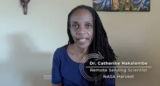
Video Description: In this close-up video, Dr. Catherine Nakalembe, Remote Sensing Scientist for …
Video Description: In this close-up video, Dr. Catherine Nakalembe, Remote Sensing Scientist for NASA Harvest, shares her passion for helping farmers around the world through the use of NASA satellites to monitor crops from space to increase sustainability. She also describes how her love for hiking, photography, and travel supports her work. Video Length: 2:09.NASA eClipsTM is a suite of online student-centered, standards-based resources that support instruction by increasing STEM literacy in formal and nonformal settings. These free digital and downloadable resources inform and engage students through NASA-inspired, real-world connections.NASA eClips Ask SME: Close-up with a NASA Subject Matter Expert videos are professionally developed to capture a glimpse of NASA SME's personal interests and career journeys. Each can be used to spark student interest and broaden their ideas of the STEM workforce. Additional videos in this series can be found by searching GoOpenVA using "NASA eClips Ask SME".
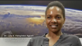
Video Description: In this close-up video, Dr. Lola Fatoyinbo Agueh, a Research Physical …
Video Description: In this close-up video, Dr. Lola Fatoyinbo Agueh, a Research Physical Scientist at NASA's Goddard Space Flight Center, shares her love for exploring new places and passion for studying Earth, from the ground to satellite imagery. Video Length: 1:51NASA eClipsTM is a suite of online student-centered, standards-based resources that support instruction by increasing STEM literacy in formal and nonformal settings. These free digital and downloadable resources inform and engage students through NASA-inspired, real-world connections.NASA eClips Ask SME: Close-up with a NASA Subject Matter Expert videos are professionally developed to capture a glimpse of NASA SME's personal interests and career journeys. Each can be used to spark student interest and broaden their ideas of the STEM workforce. Additional videos in this series can be found by searching GoOpenVA using "NASA eClips Ask SME".
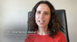
Video Description: In this close-up video, Dr. Inbal Becker-Reshef, Program Director for NASA …
Video Description: In this close-up video, Dr. Inbal Becker-Reshef, Program Director for NASA Harvest, describes her journey and how her travels as a child helped her choose a career in science over her passion for art. She shares how cameras on satellites provide data to help farmers and agricultural leaders grow more food and work toward food security worldwide. Video Length: 2:21.NASA eClipsTM is a suite of online student-centered, standards-based resources that support instruction by increasing STEM literacy in formal and nonformal settings. These free digital and downloadable resources inform and engage students through NASA-inspired, real-world connections.NASA eClips Ask SME: Close-up with a NASA Subject Matter Expert videos are professionally developed to capture a glimpse of NASA SME's personal interests and career journeys. Each can be used to spark student interest and broaden their ideas of the STEM workforce. Additional videos in this series can be found by searching GoOpenVA using "NASA eClips Ask SME".
can help families explore historic places in the U.S. Each itinerary describes …
can help families explore historic places in the U.S. Each itinerary describes historic places and their importance, and provides maps, photos, and tourist information. Find itineraries for learning about Civil War battles in Virginia, the Lewis and Clark Expedition, maritime history, women's history, civil rights movement, Florida shipwrecks, the Southwest, Amana Colonies, Ohio and Erie Canal, Detroit, the California coast, Washington, D.C., and more.
features an area in the southwest corner of Minnesota that reflects a …
features an area in the southwest corner of Minnesota that reflects a rich history of American Indian quarrying, prosperity brought by the railroad and mining enterprises, and a distinctive natural landscape. This National Register of Historic Places Travel itinerary highlights 30 historic places, including buildings constructed with beautiful local red stone and land still sacred to American Indians.
explores the city's history and shows how it continues to shape the …
explores the city's history and shows how it continues to shape the city's life today. It uses residential, commercial, industrial, and religious locations to create a tour of 37 properties that documents how past and present come together.
No restrictions on your remixing, redistributing, or making derivative works. Give credit to the author, as required.
Your remixing, redistributing, or making derivatives works comes with some restrictions, including how it is shared.
Your redistributing comes with some restrictions. Do not remix or make derivative works.
Most restrictive license type. Prohibits most uses, sharing, and any changes.
Copyrighted materials, available under Fair Use and the TEACH Act for US-based educators, or other custom arrangements. Go to the resource provider to see their individual restrictions.