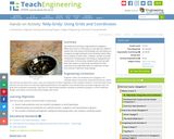
Normally we find things using landmark navigation. When you move to a …
Normally we find things using landmark navigation. When you move to a new place, it may take you awhile to explore the new streets and buildings, but eventually you recognize enough landmarks and remember where they are in relation to each other. However, another accurate method for locating places and things is using grids and coordinates. In this activity, students will come up with their own system of a grid and coordinates for their classroom and understand why it is important to have one common method of map-making.
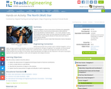
Celestial navigation is the art and science of finding one's geographic position …
Celestial navigation is the art and science of finding one's geographic position by means of astronomical observations, particularly by measuring altitudes of celestial objects sun, moon, planets or stars. This activity starts with a basic, but very important and useful, celestial measurement: measuring the altitude of Polaris (the North Star) or measuring the latitude.
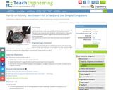
Students create and use their own simple compasses, which are each made …
Students create and use their own simple compasses, which are each made from a bowl of water, strong magnet, stick pin and Styrofoam peanuts. They learn how compasses work and about cardinal directions. They come to understand that the Earth's magnetic field has both horizontal and vertical components.
Students learn how engineers navigate satellites in orbit around the Earth and …
Students learn how engineers navigate satellites in orbit around the Earth and on their way to other planets in the solar system. In accompanying activities, they explore how ground-based tracking and onboard measurements are performed. Also provided is an overview of orbits and spacecraft trajectories from Earth to other planets, and how spacecraft are tracked from the ground using the Deep Space Network (DSN). DSN measurements are the primary means for navigating unmanned vehicles in space. Onboard spacecraft instruments might include optical sensors and an inertial measurement unit (IMU).
In this unit, students learn the very basics of navigation, including the …
In this unit, students learn the very basics of navigation, including the different kinds of navigation and their purposes. The concepts of relative and absolute location, latitude, longitude and cardinal directions are explored, as well as the use and principles of maps and a compass. Students discover the history of navigation and learn the importance of math and how it ties into navigational techniques. Understanding how trilateration can determine one's location leads to a lesson on the global positioning system and how to use a GPS receiver. The unit concludes with an overview of orbits and spacecraft trajectories from Earth to other planets.
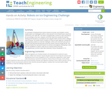
In a simulation of potential future space missions to Europa, one of …
In a simulation of potential future space missions to Europa, one of Jupiter’s moons, student teams are challenged to direct a robot placed in an enclosed maze to search for and find the most “alien life.” The robot is equipped with a camera to send a live feed of its surroundings in the maze. Students control the robot from outside the maze by looking at the live feed on a smartphone and using the robot’s remote control, making a map as they go. The student teams compete as if they are space agencies creating their own exploratory systems to meet the challenge’s criteria and constraints and prove “in the field” that they have the best plan to win the mission contract and get the job. This activity simulates the real-world research of scientists and engineers developing a robot with the capabilities to explore under the ice-covered surface of Europa.
Students explore orbit transfers and, specifically, Hohmann transfers. They investigate the orbits …
Students explore orbit transfers and, specifically, Hohmann transfers. They investigate the orbits of Earth and Mars by using cardboard and string. Students learn about the planets' orbits around the sun, and about a transfer orbit from one planet to the other. After the activity, students will know exactly what is meant by a delta-v maneuver!
You can save resources to folders you create in your space on …
You can save resources to folders you create in your space on #GoOpenVA, similarly to bookmarking resources using a browser. You can create the folders first, or create them on the fly, as you find resources you want to refer to again later. You can save folders to your private "My Items" space or to any Groups to which you belong.
The earliest explorers did not have computers or satellites to help them …
The earliest explorers did not have computers or satellites to help them know their exact location. The most accurate tool developed was the sextant to determine latitude and longitude. In this activity, the sextant is introduced and discussed with the class. Students will learn how a sextant can be a reliable tool that is still being used by today's navigators and how computers can help assure accuracy when measuring angles. Also, this activity will show how computers can be used to understand equations even when knowing how to do the math is unknown.
To navigate, you must know roughly where you stand relative to your …
To navigate, you must know roughly where you stand relative to your designation, so you can head in the right direction. In locations where landmarks are not available to help navigate (in deserts, on seas), objects in the sky are the only reference points. While celestial objects move fairly predictably, and rough longitude is not too difficult to find, it is not a simple matter to determine latitude and precise positions. In this activity, students investigate the uses and advantages of modern GPS for navigation.
Students learn that math is important in navigation and engineering. They learn …
Students learn that math is important in navigation and engineering. They learn about triangles and how they can help determine distances. Ancient land and sea navigators started with the most basic of navigation equations (speed x time = distance). Today, navigational satellites use equations that take into account the relative effects of space and time. However, even these high-tech wonders cannot be built without pure and simple math concepts â basic geometry and trigonometry â that have been used for thousands of years.
Maps are designed to allow people to travel to a new location …
Maps are designed to allow people to travel to a new location without a guide to show the way. They tell us information about areas to which we may or may not have ever been. There are many types of maps available for both recreational and professional use. A navigator uses a nautical map, while an engineer might use a surveyor's map. Maps are created by cartographers, and they can be very specific or very general, depending on their intended use. The focus of this lesson is on how to read and use topographical maps. Students will also learn to identify the common features of a map. Through the associated activities, students will learn how to use a compass to find bearing to an object on a map and in the classroom.
In this activity, students will learn how to read a topographical map …
In this activity, students will learn how to read a topographical map and how to triangulate with just a map. True triangulation requires both a map and compass, but to simplify the activity and make it possible indoors, the compass information is given. Students will practice converting a compass measurement to a protractor measurement, as well as reverse a bearing direction (i.e., if they know a tree's bearing is 100 degrees from you, they can determine what bearing they are from the tree). Students will use the accompanying worksheets to take a bearing of certain landmarks and then start at those landmarks to work backwards to figure out where they are.
In this activity, students will learn how to actually triangulate using a …
In this activity, students will learn how to actually triangulate using a compass, topographical (topo) map and view of outside landmarks. It is best if a field trip to another location away from school is selected. The location should have easily discernable landmarks (like mountains or radio towers) and changes in elevation (to illustrate the topographical features) to enhance the activity. A national park is an ideal location, and visiting a number of parks, especially parks with hiking trails, is especially beneficial.
Students learn about and use a right triangle to determine the width …
Students learn about and use a right triangle to determine the width of a "pretend" river. Working in teams, they estimate of the width of the river, measure it and compare their results with classmates.
Students learn how to identify the major features in a topographical map. …
Students learn how to identify the major features in a topographical map. They learn that maps come in a variety of forms: city maps, road maps, nautical maps, topographical maps, and many others. Map features reflect the intended use. For example, a state map shows cities, major roads, national parks, county lines, etc. A city map shows streets and major landmarks for that city, such as hospitals and parks. Topographical maps help navigate the wilderness by showing the elevation, mountains, peaks, rivers and trails.
In this activity, students will use vector analysis to understand the concept …
In this activity, students will use vector analysis to understand the concept of dead reckoning. Students will use vectors to plot their course based on a time and speed. They will then correct the positions with vectors representing winds and currents.
How do we know where we are? What happens if you are …
How do we know where we are? What happens if you are completely lost in the middle of nowhere? Does technology provide tools for people lost in their travels? A person cannot usually determine an accurate position just by looking out a window in the middle of the ocean or vast area of land, particularly if it has not been charted before. In this lesson, students explore the concept of triangulation that is used in navigation satellites and global positioning systems designed by engineers. Also, students learn how these technologies can help people determine their position or the location of someone else.
No restrictions on your remixing, redistributing, or making derivative works. Give credit to the author, as required.
Your remixing, redistributing, or making derivatives works comes with some restrictions, including how it is shared.
Your redistributing comes with some restrictions. Do not remix or make derivative works.
Most restrictive license type. Prohibits most uses, sharing, and any changes.
Copyrighted materials, available under Fair Use and the TEACH Act for US-based educators, or other custom arrangements. Go to the resource provider to see their individual restrictions.