Browse samples of USGS maps that are popular with educators. Order paper …
Browse samples of USGS maps that are popular with educators. Order paper copies through this site. Where available, links are provided to pdf versions that can be freely downloaded. (Navigate to this site on your own by going to the USGS Store and clicking on "Education Products")
Use these sites to find A map!
Education "Map Catalog"-Browse USGS paper maps that are favorites with educators.
Free Digital Topographic Maps-Download free digital maps or purchase paper maps
Geographic Names Information System (GNIS)-Database of all Federally recognized names of geographic features
This Dynamic Planet-World map of volcanoes, earthquakes, impact craters, and plate tectonics — our most popular map!
A Tapestry of Time and Terrain-Ages of rocks combined with elevation — an excellent teaching tool
National Geologic Map Database-Search for geologic maps
The National Map-Create and download your own high-resolution maps — best for advanced students
Geospatial Data and Mapping Websites-A PDF with links to the best USGS sources for geospatial data
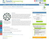
Students are introduced to the nano-size length scale as they make measurements …
Students are introduced to the nano-size length scale as they make measurements and calculate unit conversions. They measure common objects and convert their units to nanometers, giving them a simple reference frame for understanding the very small size of nanometers. Then, they compare provided length data from objects too small to measure, such as a human hair and a flea, giving them a comparative insight to the nanotechnology scale. Using familiar and common objects for comparison helps students understand more complex scientific concepts.
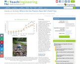
Through an adult-led field trip, students organized into investigation teams catalogue the …
Through an adult-led field trip, students organized into investigation teams catalogue the incidence of plastic debris in different environments. They investigate these plastics according to their type, age, location and other characteristics that might indicate what potential they have for becoming part of the Great Pacific Garbage Patch (GPGP). Students collect qualitative and quantitative data that may be used to create a Google Earth layer as part of a separate activity that can be completed at a computer lab at school or as homework. The activity is designed as a step on the way to student's creation of their own GIS Google Earth layer. It is, however, possible for the field trip to be a useful learning experience unto itself that does not require this last GIS step.
No restrictions on your remixing, redistributing, or making derivative works. Give credit to the author, as required.
Your remixing, redistributing, or making derivatives works comes with some restrictions, including how it is shared.
Your redistributing comes with some restrictions. Do not remix or make derivative works.
Most restrictive license type. Prohibits most uses, sharing, and any changes.
Copyrighted materials, available under Fair Use and the TEACH Act for US-based educators, or other custom arrangements. Go to the resource provider to see their individual restrictions.