In this design activity, students investigate materials engineering as it applies to …
In this design activity, students investigate materials engineering as it applies to weather and clothing. Teams design and analyze different combinations of materials for effectiveness in specific weather conditions. Analysis includes simulation of temperature, wind and wetness elements, as well as the functionality and durability of final prototypes.
CK-12 Earth Science For High School covers the study of Earth - …
CK-12 Earth Science For High School covers the study of Earth - its minerals and energy resources, processes inside and on its surface, its past, water, weather and climate, the environment and human actions, and astronomy.
In this activity, students use authentic Arctic climate data to explore albedo …
In this activity, students use authentic Arctic climate data to explore albedo and its relationship to seasonal snowmelt as a self-reinforcing feedback mechanism, which is then applied to large scale global climate change.
This activity introduces students to the Arctic and Arctic climate. Through a …
This activity introduces students to the Arctic and Arctic climate. Through a virtual exploration of the geography of the Arctic students become familiar with the region. They are then introduced to meteorological parameters that Arctic research teams use.
In this weather-related activity, learners make a portable cloud in a bottle. …
In this weather-related activity, learners make a portable cloud in a bottle. Learners discover that clouds form when invisible water vapor in the air is cooled enough to form tiny droplets of liquid water. You an accomplish the same cooling effect by rapidly expanding air in a jar using a wide-mouth jar, rubber glove, matches, and tap water. This activity can be conducted as a demonstration or by learners with adult supervision.
Students learn how the greenhouse effect is related to global warming and …
Students learn how the greenhouse effect is related to global warming and how global warming impacts our planet, including global climate change. Extreme weather events, rising sea levels, and how we react to these changes are the main points of focus of this lesson.
This article provides links to hands-on science activities that could be used …
This article provides links to hands-on science activities that could be used in an festival or informal learning event. National standards correlations are provided.
This lesson introduces the ways that engineers study and harness the wind. …
This lesson introduces the ways that engineers study and harness the wind. Students will learn about the different kinds of winds and how to measure wind direction. In addition, students will learn how air pressure creates winds and how engineers build and test wind turbines to harness energy from wind.
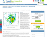
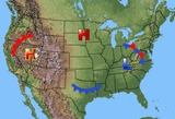
Students use a hurricane tracking map to measure the distance from a …
Students use a hurricane tracking map to measure the distance from a specific latitude and longitude location of the eye of a hurricane to a city. Then they use the map's scale factor to convert the distance to miles. They also apply the distance formula by creating an x-y coordinate plane on the map. Students are challenged to analyze what data might be used by computer science engineers to write code that generates hurricane tracking models. Then students analyze a MATLAB® computer code that uses the distance formula repetitively to generate a table of data that tracks a hurricane at specific time intervals. Students come to realize that using a computer program to generate the calculations (instead of by hand) is very advantageous for a dynamic situation like tracking storm movements. Their inspection of some MATLAB code helps them understand how it communicates what to do using mathematical formulas, logical instructions and repeated tasks. They also conclude that the example program is too simplistic to really be a useful tool; useful computer model tools must necessarily be much more complex.
This activity is a field investigation where students gather temperature and weather …
This activity is a field investigation where students gather temperature and weather data in the a.m and p.m. and develop a new, experimental question to predict temperature over the course of the year.
Students follow weather forecasts to gauge their accuracy and produce a weather …
Students follow weather forecasts to gauge their accuracy and produce a weather report for the class. They develop skills of observation, recording and reporting.
This is a review and introduction to climate change using videos from …
This is a review and introduction to climate change using videos from National Geographic. It includes a follow up research activity on the impact of climate change on specific biomes around the globe.
This article discusses how the study of weather can meet the NCTM …
This article discusses how the study of weather can meet the NCTM Data Analysis and Probability standard. Links to lessons for grades K-2 and 3-5 are provided.
This is a complete 5 E lesson covering weather and weather maps. …
This is a complete 5 E lesson covering weather and weather maps. Materials will be available that can be used for teacher instruction on weather maps. Students will have opportuities to investigate and analyze weather maps and make predictions using maps for impending weather.
No restrictions on your remixing, redistributing, or making derivative works. Give credit to the author, as required.
Your remixing, redistributing, or making derivatives works comes with some restrictions, including how it is shared.
Your redistributing comes with some restrictions. Do not remix or make derivative works.
Most restrictive license type. Prohibits most uses, sharing, and any changes.
Copyrighted materials, available under Fair Use and the TEACH Act for US-based educators, or other custom arrangements. Go to the resource provider to see their individual restrictions.