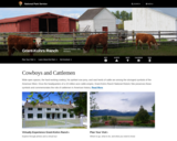
The Grant-Kohrs Ranch commemorates America's frontier cattle era. The ranch, located north …
The Grant-Kohrs Ranch commemorates America's frontier cattle era. The ranch, located north of Yellowstone in Deer Lodge, Montana, is among the best surviving examples of an economic strategy based on the western cattle industry of the 1850s-1970s. A German immigrant, Conrad Kohrs, purchased the ranch in 1866 and began by supplying to mining camp butcher shops.
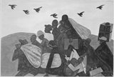
The student will apply social science skills to understand how the nation …
The student will apply social science skills to understand how the nation grew and changed from the end of Reconstruction through the early twentieth century by e) evaluating and explaining the social and cultural impact of industrialization, including rapid urbanization; Great Migration.
presents 26 historic places?barns, civic buildings, churches, railroad depots, schools, and libraries?that depict the history of this county, known as the Heart of the Heartland.
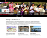
offers educators Park Service resources that help teach about our nation's cultural …
offers educators Park Service resources that help teach about our nation's cultural heritage, and which look at how the NPS is protecting and preserving them. Subjects include archaeology, historic buildings and structures, mapping, military history, and national historic landmarks. The resources may be in the form of learning programs, case studies, lesson plans, teachers' handbooks, and more.
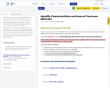
There are several common minerals that tend to be referenced and used …
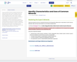
There are several common minerals that tend to be referenced and used in texts, NY Regent Tests and released Virginia SOL tests.
I call these the Super 8. Sulfur | Magnetite | Mica | Halite | Pyrite | Calcite | Quartz | Diamond
This resource requires samples of each mineral be sorted and available for manipulation. Students should perform this lab in small groups 3 or 4 and use the spreadsheet provided write the features observed according to categories the teacher wants students to master.
The lab should take about 20-30 minutes.
The Earth Science textbook by Glenco or the attached reference sheet may be used by students.
There are several common minerals that tend to be referenced and used …
There are several common minerals that tend to be referenced and used in texts, NY Regent Tests and released Virginia SOL tests.
I call these the Super 8. Sulfur | Magnetite | Mica | Halite | Pyrite | Calcite | Quartz | Diamond
This resource requires samples of each mineral be sorted and available for manipulation. Students should perform this lab in small groups 3 or 4 and use the spradsheet provided write the features observed according to categories the teacher wants students to master.
The lab should take about 20-30 minutes.
The NY Regents Earth Science Reference Table or a textbook reference may be used as a group reference for look up.
is a guide to these mounds, built between 100 B.C. and 1700 …
is a guide to these mounds, built between 100 B.C. and 1700 A.D. to bury important members of tribes and to serve as platforms for temples or residences of chiefs. This website highlights 11 mound sites and includes itineraries and three essays that provide historical context for these sites.
Infrastructure is Good for Business; During the Depression, business leaders knew that …
Infrastructure is Good for Business; During the Depression, business leaders knew that public works funding was key to economic growth. Why have we forgotten that lesson?
Introuction to physical and human geography of Southwest Virginia, highlighting places visited …
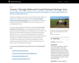
Introuction to physical and human geography of Southwest Virginia, highlighting places visited by AP Human Geography teachers. Coal mining is highlighed, focusing on resource extraction techniques, impacts on the environment and possible solutions.
The second of two lessons on Islamic Empires, students examine maps showing …
The second of two lessons on Islamic Empires, students examine maps showing the territorial extent of each of the three major Islamic Caliphates. This examination, showing the same territory through different time periods, provides a springboard for analyzing historical factors underlying the territorial changes. Students also explore cultural, economic, and political factors that account for the changing borders as they match explanations associated with the changes in the maps. Key questions: How did the borders of the Islamic Empires change through time? What cultural, economic, and political factors could account for the changing borders?
The first of two lessons on Islamic Empires, students examine physical maps …
The first of two lessons on Islamic Empires, students examine physical maps and assess the possibility of geographic obstacles to the diffusion of Islam. They also explore connections among locations that are incorporated into the succession of empires. Students tie events and locations together through the creation of an annotated map based on selected events. The lesson concludes with an examination of a concentric circle map that provides a rough estimate of distances among the various locations. Key questions: How has physical geography influenced the expansion of the Islamic Empire? Why and how did Islam diffuse so rapidly?
This Story Map Journal emphasizes geography’s impact on United States’ strategy in …
This Story Map Journal emphasizes geography’s impact on United States’ strategy in fighting World War II in the Pacific. Students, through the use of Library of Congress resources explore geography’s impact on the average soldier in the Pacific. They will also chart the progress that the armed forces made in their attempt to hop over non-strategic islands in their attempts to get ever closer to the home islands of Japan. Based on the images obtained from the Library of Congress, students will be able to critically assess the toll that the geography of the Pacific took on soldiers. Contains links to student materials and teacher materials for creating lesson plans.
visits 65 historic places along 75 miles of Route 15 in Virginia's …
visits 65 historic places along 75 miles of Route 15 in Virginia's Piedmont. Stops include homes of Thomas Jefferson and James Monroe; sites of some of the bloodiest battles in the Civil War; and other places that evoke the soldiers, statesmen, farmers, and slaves who fought, toiled, and governed there.
explores Kingston's over 300 years of history using 24 historic places that …
explores Kingston's over 300 years of history using 24 historic places that recall past eras when settlers and Native Americans warily shared its plains, proud Revolutionaries and angry British armies walked its narrow streets and when coal, limestone and even patent medicines flowed along its canals. The Dutch established Kingston 1652 and it became an active participant in the American Revolution and a major river-port during New York's 19th-century canal and steamboat era.
The purpose of this lesson is for students to understand that economic …
The purpose of this lesson is for students to understand that economic activity can be classified as primary, secondary, tertiary, or quaternary; students will define the different levels of economic activity and categorize various activities by its level.
No restrictions on your remixing, redistributing, or making derivative works. Give credit to the author, as required.
Your remixing, redistributing, or making derivatives works comes with some restrictions, including how it is shared.
Your redistributing comes with some restrictions. Do not remix or make derivative works.
Most restrictive license type. Prohibits most uses, sharing, and any changes.
Copyrighted materials, available under Fair Use and the TEACH Act for US-based educators, or other custom arrangements. Go to the resource provider to see their individual restrictions.