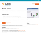
This 90-minute activity features six interactive molecular models to explore the relationships …
This 90-minute activity features six interactive molecular models to explore the relationships among voltage, current, and resistance. Students start at the atomic level to explore how voltage and resistance affect the flow of electrons. Next, they use a model to investigate how temperature can affect conductivity and resistivity. Finally, they explore how electricity can be converted to other forms of energy. The activity was developed for introductory physics courses, but the first half could be appropriate for physical science and Physics First. The formula for Ohm's Law is introduced, but calculations are not required. This item is part of the Concord Consortium, a nonprofit research and development organization dedicated to transforming education through technology. The Concord Consortium develops deeply digital learning innovations for science, mathematics, and engineering.
This concept-building activity contains a set of sequenced simulations for investigating how …
This concept-building activity contains a set of sequenced simulations for investigating how atoms can be excited to give off radiation (photons). Students explore 3-dimensional models to learn about the nature of photons as "wave packets" of light, how photons are emitted, and the connection between an atom's electron configuration and how it absorbs light. Registered users are able to use free data capture tools to take snapshots, drag thumbnails, and submit responses. This item is part of the Concord Consortium, a nonprofit research and development organization dedicated to transforming education through technology.
The lessons included in the attached Google Slides incorporate standards from Computer …
The lessons included in the attached Google Slides incorporate standards from Computer Science, Math, Language Arts, and Physical Education. The lessons all focus on conditional statements (IF, THEN, ELSE) and can easily be adapted to fit any grade from kindergarten to fifth grade.
Learn about what copyright does—and does not—cover in our Circulars. These guides …
Learn about what copyright does—and does not—cover in our Circulars. These guides provide detailed, up-to-date information to explain copyright to the public.
This resource consists of a Java applet and expository text. The applet …
This resource consists of a Java applet and expository text. The applet is a simulation of the coupon collector problem, which consists of sampling from the first m positive integers, with replacement, until k distinct values are obtained. The parameters m and k can be varied. The random variable of interest is the size of the sample.
This resource consists of a Java applet and expository text. The applet …
This resource consists of a Java applet and expository text. The applet is a simulation of the standard casino craps game. The random variables of interest are the winning under various bets.
It is suggested that this activity be used once students have a …
It is suggested that this activity be used once students have a deep understanding of parallel and perpendicular lines. Students will be given the equation of a line in various forms and based on that information, must drag points on a graph to create parallel and perpendicular lines. Initially students will not be shown the graph of the original line, but can obtain that hint if necessary. Once students submit their solutions on the graph, they can reveal the answer, but will no longer be able to adjust their work. This could be used as an assessment, especially during distance learning.
This unit is geared toward students in 4th grade. This lesson has …
This unit is geared toward students in 4th grade. This lesson has students identify why passwords are important and how we can create and remember strong passwords that keep our information safe while online. There are mutltiple resources with this lesson including the lesson plan, a slides presentation to guide the lesson, and interactive video guide, and finally a password practice sheet. This lesson could be divided up over multiple days and can also be differentiated to different age students.
This is a professional learning OER activity developed using Google Sites and …
This is a professional learning OER activity developed using Google Sites and various Google Forms and Docs. The facilitator should be sure to set up the site with their own forms, etc... The objectives for the staff are:Understand the basics of copyright lawUnderstand fair use guidelinesIdentify the types of CC licenses and termsUnderstand the benefits of Open AccessUnderstand the benefits of Open Educational Resources
This is a virtual learning assignment that could be used in any …
This is a virtual learning assignment that could be used in any course to address current events, information literacy skills, and media literacy skills. Please note that the assignment references a proprietary resource: the Proquest online database. Teachers may need to modify the referenced resource (particularly in Phase 1) to include one that is available to their students.
Making a report of child exploitation is secure and easy. The form …
Making a report of child exploitation is secure and easy. The form can be completed in just a few minutes, and you decide if you want to share your contact information. In fact, many of the fields are optional so what information you provide, is up to you.
In this lesson, students will learn about why their personal information is …
In this lesson, students will learn about why their personal information is important and how they can keep it safe. They will also learn to pull out other people’s personal information and how that character/person can keep it safe.
Explore the relationship between the genetic code on the DNA strand and …
Explore the relationship between the genetic code on the DNA strand and the resulting protein and rudimentary shape it forms. Through models of transcription and translation, you will discover this relationship and the resilience to mutations built into our genetic code. Start by exploring DNA's double helix with an interactive 3D model. Highlight base pairs, look at one or both strands, and turn hydrogen bonds on or off. Next, watch an animation of transcription, which creates RNA from DNA, and translation, which 'reads' the RNA codons to create a protein.
Data Science is a growing field across all disciplines and grade levels. …
Data Science is a growing field across all disciplines and grade levels. Use the assets in this collection to help learn valuable skills and concepts related to collecting, using, analyzing, and presenting data. The VDOE, Data Science Teachers, and WHRO Education collaboratively created this content.
Mic Drop Maths is a mathematics podcast for 5th graders based on …
Mic Drop Maths is a mathematics podcast for 5th graders based on the VA Standards of Learning. Each episode addresses one standard and is broken into segments including concept, real-world application, math history, literature connections, misconceptions, and more! There is music, sound effects, jokes, and student voice in each engaging and entertaining episode.
This resource consists of a Java applet and expository text. The applet …
This resource consists of a Java applet and expository text. The applet simulates rolling n dice. The random variables of interest are the sum of the scores, the maximum score, the minimum score, and the number of aces. The number of dice and the probability distribution that governs the dice can be specified. The applet illustrates various distributions and the central limit theorem.
This resource consists of a Java applet and expository text. The applet …
This resource consists of a Java applet and expository text. The applet simulates the rolling of n dice. The number of dice and the probability distribution that governs the dice can be specified.
This resource consists of a Java applet and expository text. The applet …
This resource consists of a Java applet and expository text. The applet simulates the experiment of rolling a die and then tossing a coin the number of times shown on the die. The die distribution and the probability of heads can be specified. The applet illustrates a two-stage experiment.
No restrictions on your remixing, redistributing, or making derivative works. Give credit to the author, as required.
Your remixing, redistributing, or making derivatives works comes with some restrictions, including how it is shared.
Your redistributing comes with some restrictions. Do not remix or make derivative works.
Most restrictive license type. Prohibits most uses, sharing, and any changes.
Copyrighted materials, available under Fair Use and the TEACH Act for US-based educators, or other custom arrangements. Go to the resource provider to see their individual restrictions.