Students will examine two paintings and discuss the use of architectural elements …
Students will examine two paintings and discuss the use of architectural elements and vantage points in the paintings. Referring to the elements of art, students will also examine how three-dimensional shapes are transformed into two-dimensional forms in paintings, as well as the use of indoor space vs. outdoor space.
In the second lesson of four on Ancient Greece, students refine their …
In the second lesson of four on Ancient Greece, students refine their knowledge of physical features as they investigate pictures of Greece and determine how a particular physical feature influenced human action. Key question: How did the physical geography of the Aegean basin shape the economic, social and political development of Greek civilization?
In the first lesson of four on Ancient Greece, students use geographic …
In the first lesson of four on Ancient Greece, students use geographic terms such as hemispheres, continents, and direction to describe the relative location of Greece within the world, within Europe, and within the Aegean Basin. In addition, students extend and refine their ability to identify various types of physical features on maps at a variety of scales. Students examine maps to identify and describe the physical environment of Greece. Key questions: Where is ancient Greece located?; What are physical features of the Aegean Basin?; How did the location of Greece and its physical environment influence its interaction with the rest of the world?
In the third lesson of four on Ancient Greece, students simulate trade …
In the third lesson of four on Ancient Greece, students simulate trade between Greek city states and their colonies. The overall goal is for the Greek traders and colonists to travel to new territories, trade resources, and as a result build an empire and spread Hellenistic culture. Through the examination of the goods exchanged, students gain a basic understanding of specialization in the various areas of the Mediterranean Basin. Key questions: Why did the Greeks acquire colonies?; How did Greek culture diffuse throughout the Mediterranean world?; What were the effects of the diffusion of Greek culture?
In the last lesson of four on Ancient Greece, students employ spatial …
In the last lesson of four on Ancient Greece, students employ spatial thinking to understand the extent of the empire of Alexander the Great by examining and comparing visuals and maps. Key question: How does the geographic extent of an empire influence its ability to exist through time?
In the first of two lessons on ancient river valley civilization, students …
In the first of two lessons on ancient river valley civilization, students examine the physical environment of the early river valley civilizations. After identifying the locations of the ancient civilizations, students complete a feature analysis to assist them in comparing the physical environments and determining how it afforded protection to the civilizations. Key questions: Why was a river valley a good place for a settlement? What was the significance of these river valley civilizations?
In the second of two lessons on ancient river valley civilizations, students …
In the second of two lessons on ancient river valley civilizations, students examine the physical environment of the early river valley civilizations. Moving water carries and sorts sediment, changes landforms, and creates strata. The sediment becomes the base for soil formation, and it is the material of which flood plains, deltas, and natural levees are built. Through a demonstration of the sedimentation process, students will come to understand the significance of the process and seasonal flooding to agricultural activity in the early river valley civilizations. Key questions: How does the process of sedimentation affect soil fertility? Why are some river valleys good sites for human settlement?
The first lesson of two on Ancient Rome, students examine physical maps …
The first lesson of two on Ancient Rome, students examine physical maps of Rome to identify physical features that provided security for the site of Rome. In addition, students examine the relative location of Rome and its connections within the Mediterranean Basin and beyond. The second segment of the lesson examines the expansion of the Roman Empire through time and the role of physical features in facilitating or hindering that expansion. Key questions: What are the physical features of Rome?; How did the physical geography of Rome influence its development?
The second lesson of two on Ancient Rome, students examine the geographic …
The second lesson of two on Ancient Rome, students examine the geographic extent of the Roman Empire. The Orbis Web site, hosted by Stanford University, provides a map of the Roman Empire at its largest extent with the locations of key cities and transportation links. Key questions: How were places within the Roman Empire connected?; How did time and distance affect interactions within the Roman Empire?
Students will examine the use of the elements of art, including line, …
Students will examine the use of the elements of art, including line, shape, form, texture, and color, in a drawing. They will also study the elements of architecture and learn to identify architectural elements in detail and their relationship to the surrounding landscape. Then students will draw an ancient Roman temple in perspective, integrating architectural elements in the drawing.
Students participate in a measurement lesson focusing on length. They use their …
Students participate in a measurement lesson focusing on length. They use their feet as the unit of measurement for furniture in the classroom and at home. They then sketch the pieces of furniture they measured.
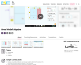
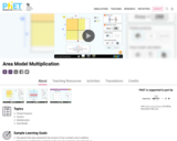
Build rectangles of various sizes and relate multiplication to area. Discover new …
Build rectangles of various sizes and relate multiplication to area. Discover new strategies for multiplying algebraic expressions. Use the game screen to test your multiplication and factoring skills!
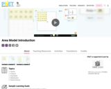
Build rectangles of various sizes and relate multiplication to area. Discover new …
Build rectangles of various sizes and relate multiplication to area. Discover new strategies for multiplying large numbers. Use the game screen to test your problem solving strategies!
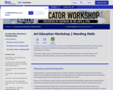
Partners in the Arts at the University of Richmond joined with VPM …
Partners in the Arts at the University of Richmond joined with VPM and Mending Walls RVA to create a virtual workshop, introducing the Mending Walls processes of building empathy through conversations, and collaborating to create art.
This resource offers videos of the workshop through a StoryMap that features artist discussions, and a participant’s guide with questions, prompts, and activities for educators to use with their students.
Learn about visual and performing artists. They often use their creativity to …
Learn about visual and performing artists. They often use their creativity to raise their voices and share lessons, stories, and important ideas with the world. In this episode of The Creative Corner, two artists from Richmond, Virginia help us explore how art sparks crucial conversations. Public artist Hamilton Glass shares how (and why) he gathered a group of artists to paint murals with a message all across the city after some challenging current events, and musician Victor Haskins talks about storytelling as human nature — and why sound and performance tell stories so well. Then you’re invited to share your own voice through a poster project!
Students will learn about the jazz singer Billie Holiday and the sociohistorical …
Students will learn about the jazz singer Billie Holiday and the sociohistorical context in which she performed. They will learn how discriminatory statutes (called Jim Crow laws) affected daily life. They will also analyze how movement is created in photographs and the effect of a photographer's point of view on composition. Finally, students will photograph a musician, paying attention to what can be communicated through point of view.
Students will analyze scenes from the Trojan War that are visually depicted …
Students will analyze scenes from the Trojan War that are visually depicted in an ancient object and an 18th-century painting. They will research an epic poem inspired by the Trojan War and write a literary response analyzing how themes and values in the poem reflect the historical context in which they were made. Finally, they will work in teams to reframe a tale from the Trojan War in a contemporary context -- visually and in poetry -- and recite the tale in a poetry slam.
Students will discuss what is communicated in an ancient statuette by analyzing …
Students will discuss what is communicated in an ancient statuette by analyzing the size and poses of two figures. They will learn that stories were passed through oral tradition in ancient times. They will create sculptures of themselves, a companion, and a favorite musical instrument using spheres and cylinders, and then recite a story inspired by their sculptures.
No restrictions on your remixing, redistributing, or making derivative works. Give credit to the author, as required.
Your remixing, redistributing, or making derivatives works comes with some restrictions, including how it is shared.
Your redistributing comes with some restrictions. Do not remix or make derivative works.
Most restrictive license type. Prohibits most uses, sharing, and any changes.
Copyrighted materials, available under Fair Use and the TEACH Act for US-based educators, or other custom arrangements. Go to the resource provider to see their individual restrictions.